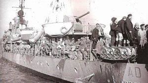
Ardente Wreck
| Field | Value |
|---|---|
| Wreck Category | non-dangerous wreck |
| Status | Dead = Not detected by numerous sources therefore considered not to exist |
|
Ardente Wreck Location Marine Coordinates (DMM) |
38 8.5 N,12 35.95 E |
| Latitude, Longitude Decimal Degrees |
|
| Water Depth | 250 m |
| Water Level Effect | always under water/submerged |
| Vertical Datum | Mean Low Water Springs |
| Name | ARDENTE |
| Type | torpedo boat |
| Flag | IT |
| Length | 83.5 m |
| Width | 9.4 m |
| Draught | 2.4 |
| Tonnage | 860 |
| Tonnage Type | gross |
| Conspic Visual | not visually conspicuous |
| Conspic Radar | not radar conspicuous |
| Date Sunk | Jan 12, 1943 |
| Bottom Texture | Sand |
| Original Detection Year | 1976 |
| Last Detection Year | 2022 |
| Original Source | other |
| Last Amended Date | Jan 16, 2023 |
Circumstances of loss
VESSEL, ITALIAN TORPEDO BOAT, BUILT 1942 SANK AFTER A COLLISION WITH THE DESTROYER `GRECALE', OFF PUNTA BARONE. CASUALTIES, IF ANY, ARE UNKNOWN. (DODS).
WRECK MAP LOADING ...
38 8.5 N,12 35.95 E
Ardente on Wreck Map
Ardente Wreck on Google Map
Nearby Wrecks:
- Devoli Wreck 2388.2 M
- Other Wreck 90319 3928.2 M
- Ticino Wreck 8111.3 M
- Verde Wreck 9041.1 M
- Enotria Wreck 10618.6 M
- Other Wreck 74097 12310.2 M
- Other Wreck 74069 13064.4 M
- Pavlos V (Possibly) Wreck 13729.1 M
- Pavlos (Possibly) Wreck 13802.6 M
- Giorgio Wreck 14167.1 M