All Other Wrecks
View All Other on the Wreck MapOther Wreck 62406
SMALL ISOLATED FEATURE PROTRUDING FROM THE SEABED. SURROUNDED BY SCOUR PIT.
Other Wreck 62407
UK NM 3912/20
Other Wreck 62408
UK NM 3912/20
Other Wreck 62409
UK NM 3912/20
Other Wreck 62414
WRECK APPEARS INTACT. MINIMAL SCOUR OBSERVED TO THE NORTH WEST OF THE WRECK.
Other Wreck 62415
Survey APBS 2020
Other Wreck 62416
SMALL UNIDENTIFIED FEATURE. NO EVIDENCE OF SCOUR OR DEBRIS AROUND THE FEATURE.
Other Wreck 62421
WRECK APPEARS TO BE BROKEN INTO TWO PARTS, SCOUR OBSERVED TO THE NORTH OF THE WRECK, NO DEBRIS OBSERVED.
Other Wreck 62427
NO 2
Other Wreck 62431
WRECK HAD BEEN DESIGNATED AS ïÃÃ...
Other Wreck 62432
SINGLE ISOLATED FEATURE PROTRUDING FROM SEABED. SCOURING EVIDENT TO THE SOUTHEAST OF THE FEATURE.
Other Wreck 62438
SMALL WK OR WRECKAGE LARGELY BROKEN UP AND NOT WELL DEFINED. NO PROTRUDING STRUCTURE EVIDENT. SOME DEBRIS NEAR STERN AND MINIMAL SCOURING TO THE N OF...
Other Wreck 62447
WRECK APPEARS AS A SMALL STRUCTURE PROTRUDING FROM THE SEAFLOOR, SUROUNDED BY SCOUR PIT.
Other Wreck 62450
WRECK APPEARS MAINLY AS AN ISOLATED, MOUND-LIKE FEATURE. SCOUR PIT SURROUNDS WRECKAGE.
Other Wreck 62452
SINGLE ELONGATED FEATURE WITH NO STRUCTURAL DEFINITION OR PRONOUNCED FEATURES APPARENT. SCOURING TO THE NE. NO DEBRIS FIELD.
Other Wreck 62456
Sunken Pontoon
Other Wreck 62457
Pontoon
Other Wreck 62458
UK NM 5323/20
Other Wreck 62460
UK NM 5373/20
Other Wreck 62475
Four pipelines crossing each other.
Wreck 62477
18.10.2016 A DREDGE PIPE LOST BY DREDGER MV WELSH PIPER WHILIST DREDGING ON AREA 392. (EMAIL FROM SAMUEL WILLIS, 19.10.2016)
Other Wreck 62480
RUINED OIL PLATFORM
Other Wreck 62481
UNDERWATER TURBINE DECOMMISSIONED. UK NM 5720/19
Other Wreck 62482
UK NM 5323/20 ANCHORING, STOPPING, FISHING & DIVING PROHIBITED, REST'D AREA RADIUS 100MTRS
Other Wreck 62488
UK NM 6027/20.
Other Wreck 62489
UK NM 6172/20.
Other Wreck 62492
UK NM 6103/20.
Other Wreck 62493
UK NM 6103/20.
Other Wreck 62494
UK NM 6057/20
Other Wreck 62495
UK NM 6070/20.
Other Wreck 62497
UK NM 6063/20.
Other Wreck 62498
UK NM 6098/20.
Other Wreck 62499
UK NM 6103/20.
Other Wreck 62500
UK NM 6103/20.
Other Wreck 62502
UK NM 3075/19
Other Wreck 62503
UK NM 5916/20.
Other Wreck 62504
UK NM 6103/20.
Other Wreck 62506
UK NM 5984/20.
Other Wreck 62507
UK NM 6103/20.
Other Wreck 62508
Rep (2019). UKHO NM 4615/19.
Other Wreck 62509
UK NM 6027/20.
Other Wreck 62511
UK NM 6103/20.
Other Wreck 62512
UK NM 5984/20.
Other Wreck 62513
UK NM 6134/20.
Wreck 62514
UK NM 6091/20.
Other Wreck 62517
UK NM 6027/20.
Other Wreck 62524
UK NM 5844/20.
Other Wreck 62526
UK NM 5451/20
Other Wreck 62531
UK NM 5984/20.
Other Wreck 62532
UK NM 5451/20
Other Wreck 62534
UK NM 5844/20.
Other Wreck 62539
APPEARS UPRIGHT, WITH DAMAGED BOWS. UK NM 5688/20.
Other Wreck 62540
APPEARS SPLIT AMIDSHIPS. UK NM 5688/20.
Other Wreck 62542
UPRIGHT. PARTIALLY DEGRADED. UK NM 5688/20.
Other Wreck 64000
Former Marine Farm
Other Wreck 64008
UK NM 2986/18
Other Wreck 64022
UK NM 5350/20. No anchoring/fishing/underwater activities - 400m Rest'D area.
Other Wreck 64026
ARTIFICIAL STRUCTURES
Other Wreck 64029
FORMER MARINE FARM
Other Wreck 64030
TERRACOTTA STATUE
Other Wreck 64032
HULL OF LEISURE CRAFT
Other Wreck 64051
Rest'D Zone radius 300m.
Other Wreck 64053
Rest'D zone 300m radius. No Diving/fishing/anchoring/salvage
Other Wreck 64054
UK NM 1558/21
Other Wreck 64056
Restricted area radius 300m
Other Wreck 64058
Not full investigation
Other Wreck 64061
UK NM 1643/21
Other Wreck 64067
Rest'D zone 300m radius. No Diving/fishing/anchoring/salvage
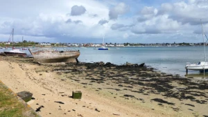
Other Wreck 64068
Not full investigation
Other Wreck 64072
SEP 2020/000105270 22.04.2021 EXAM'D 10.12.20 IN 5146.410N,0005.391E. LEAST DEPTH DRYING 6.44MTRS IN GEN DEPTH DRYING 5MTRS. LENGTH 13.4MTRS, WIDT...
Other Wreck 64075
Rest'D zone 300m radius. No Diving/fishing/anchoring/salvage
Other Wreck 64076
UK NM 1603/21
Other Wreck 64078
UK NM 1643/21
Other Wreck 64079
UK NM 1590/21
Other Wreck 64090
Concrete blocks
Other Wreck 64093
Foul area of sunken vessel. ID NM 10/126(P)/21 cancelled
Other Wreck 64094
Concrete blocks
Other Wreck 64099
Concrete blocks
Other Wreck 64101
Concrete blocks
Other Wreck 64104
Rest'D Zone radius 300m
Other Wreck 64109
STEEL ANGLE BEAMS
Other Wreck 64112
Concrete blocks
Other Wreck 64113
Concrete blocks
Other Wreck 64118
Concrete blocks
Other Wreck 64119
Concrete blocks
Other Wreck 64124
Concrete blocks
Other Wreck 64128
Concrete blocks
Other Wreck 64132
Concrete blocks
Other Wreck 64134
Concrete blocks
Other Wreck 64150
Concrete blocks
Other Wreck 64151
Concrete blocks
Other Wreck 64158
Concrete blocks
Other Wreck 64159
Concrete blocks
Other Wreck 64164
Concrete blocks
Other Wreck 64168
Reported (1970)
Other Wreck 64169
Concrete blocks
Other Wreck 64170
Concrete blocks
Other Wreck 64171
Concrete blocks
Other Wreck 64173
Concrete blocks
Other Wreck 64178
UK NM 1781/21